
On 10 November 2026 Pietro Miotti, an AI researcher living in Zurich, described how his AI agents identified a Maya settlement in Mexico that, as far as anyone can tell, had never been reported. The agents worked on public NASA lidar data. Less than 72 hours passed between the idea, which came to him on holiday in Peru, and the reply from INAH, Mexico’s National Institute of Anthropology and History.
Miotti is not an archaeologist and says so at the start. With a group of agents he covered, in three days, the whole path from raw data to a formal report to a scientific institution.
Seventy-two hours from idea to reply
The timeline is the one Miotti gives in the diary in his post.
- 18 October. In Peru, while asking an AI model about Hiram Bingham and the discovery of Machu Picchu, Miotti wonders what an explorer would use today. Gemini, ChatGPT, Claude and Grok all suggest lidar. He picks Maya territory because public lidar coverage there is much better than in Peru. In the evening he hands the analysis to the agents and goes to bed.
- 19 October. By morning the agents have found many villages and other regular shapes. Miotti asks them to check against the literature and the archives, and after a few hours one agent reports that one of the larger settlements does not seem to be registered.
- 20 October. The agents check slices of the raw point cloud, refine the report and translate it into Spanish, a language Miotti does not speak. The report goes to INAH with the exact coordinates in a confidential annex.
- 21 October. INAH replies that no registered archaeological site was identified at the location given.
The method
The data come from G-LiHT, the airborne system of NASA’s Goddard Space Flight Center that combines lidar, an imaging spectrometer and a thermal sensor. It was designed for ecosystem studies, meaning plant species composition, biomass and carbon. NASA distributes the data as open access, and the survey Miotti used dates from 2013. Some of the lidar pulses pass through gaps in the canopy and reach the ground, and from those returns the bare terrain is reconstructed, where structures built by the Maya remain visible as regular relief. At the reported spot the forest is 10–17 metres tall.
Miotti turned the survey strips, about 1,200 km² of jungle, into images and had 48 agents examine them in parallel. Each agent looked for pyramids, platforms and plazas, and discarded natural hills, sinkholes and roads. Miotti notes that he used no purpose-built model or classifier. He used general-purpose agents, instructed in natural language.
After the search for shapes the agents checked the candidates against the literature and existing registers, re-examined the best candidate on the raw data and drafted a report in Spanish for the competent authority. Literature review, verification and drafting are steps that usually call for different skills and more people.
Archaeologists have been reusing lidar surveys made for other purposes for years. In 2024 Luke Auld-Thomas and colleagues described Valeriana, a Maya city in the state of Campeche, in Antiquity, together with 6,764 structures over about 122 km². The survey had been flown in 2013 for a forest-monitoring project. That work was done by specialist archaeologists. In Miotti’s case the selection of candidates, the literature check and the report were done by the agents.
What was found
According to Miotti’s and the agents’ reading of the lidar, the site has a levelled plaza, an oval pyramid estimated at 8–12 metres tall, a raised courtyard and a flat-bottomed hollow that may have been a water reservoir, an aguada. Next to it there are three smaller platforms, probably houses. Miotti explicitly presents the attribution to a small Classic-period civic centre, between AD 250 and 900, as a hypothesis that came out of a long conversation with the agents.
INAH’s reply concerns the registers, and the existence of the site still has to be confirmed. Miotti says plainly that it is not official yet. In Mexico archaeological sites are protected by federal law and any fieldwork needs INAH’s authorisation. A site visit is now up to the INAH centre responsible for the area.
Two nineteenth-century precedents
Maya country has a direct precedent. In 1839 John Lloyd Stephens, a New York lawyer and travel writer, left for Central America on a diplomatic commission from President Van Buren. He took with him Frederick Catherwood, an English architect and draughtsman who had already drawn monuments in Egypt and Palestine. Neither of them was an archaeologist. In two expeditions, the first in 1839–40 and the second from October 1841, they documented 44 Maya sites, among them Copán, Palenque, Uxmal, Chichén Itzá and Tulum. In the books that followed, Incidents of Travel in Central America, Chiapas, and Yucatan in 1841 and Incidents of Travel in Yucatan in 1843, illustrated by Catherwood, they argued that those cities had been built by the Maya rather than by Old World peoples, as other theories held. Catherwood’s drawings still have archaeological value, because some of those sites have deteriorated since. Stephens, though, also had a collector’s ambitions. At Copán he paid 50 dollars to Don José María, who held the land on a lease, and planned to take the monuments to New York as the nucleus of a national museum of American antiquities. Rapids on the river made the transport impossible, and he fell back on the idea of cutting one up and making casts of the others.
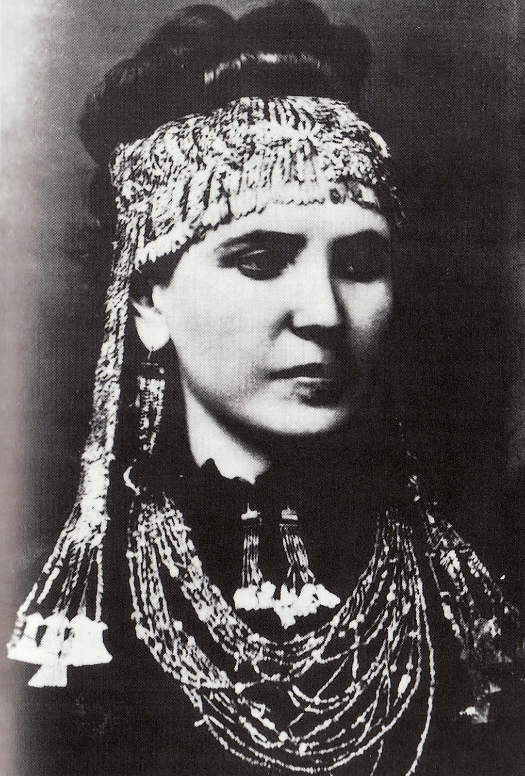
The cover photo shows Sophia Schliemann wearing the jewellery her husband Heinrich found at Troy in 1873. Heinrich Schliemann is the best-known case of an outsider who came to archaeology on his own. Born in 1822 in Neubukow, Mecklenburg, to a family too poor to send him to university, he made his fortune in trade. He represented an import-export firm in St Petersburg. During the California gold rush he opened a bank in Sacramento that bought and resold over a million dollars’ worth of gold dust in six months, then made more money in indigo. In 1858, at 36, he was rich enough to retire and devote himself to Homer. By the end of his life he could converse in a dozen languages besides German.
He did not reach Troy alone. Frank Calvert, who owned half of the mound at Hisarlik and had begun digging there seven years before him, persuaded him that Troy was there. Schliemann opened a large trench in the mound and by 1873 had recognised several superimposed cities. That year he found the treasure and attributed it to Priam, but the layer it came from, Troy II, is more than a thousand years older than the city Priam would have ruled. He smuggled the treasure to Greece, and the Ottoman government revoked his excavation permit and sued him. The story of Sophia carrying the jewels away in her shawl was his own invention, as he later admitted. His digging has been criticised for destroying important remains, including the layer believed to be Homeric Troy. He was also accused of taking advantage of Calvert.
Stephens and Catherwood documented an entire civilisation without training as archaeologists. Schliemann had his own capital, no regular university education and a determination that did not stop at scruples, which led him to cut through a stratified site with a trench to reach what he was looking for. Agents now give outsiders a computational workforce that works in parallel. Schliemann dug with labourers, whereas Miotti’s agents examined 1,200 km² in one night, and their capacity grows with the number of agents launched together.
Compared with these precedents there are two differences. Lidar and agents read the ground without touching it, and the digging is left to those authorised to do it. And Miotti handed the coordinates to the country’s authority, whereas Stephens wanted to take the Copán monuments to New York and Schliemann took the treasure away.
Superpowers to wear
Miotti closes his post like this: “Being a naive outsider might be a superpower now”. With agents, someone from outside a field can see through, alone, problems they could not have taken on before.
It is the same way of working I described for Anthropic’s agent campaign that found a new family of enzymes by sifting through 1.9 billion protein clusters in twenty-one and a half hours. In both cases there are many agents in parallel on public data, a filter on the candidates, a comparison with what is already known and a result handed to those who can verify it.
This is why I think it is fair to speak of superpowers that can be worn. Agents extend what a person can do: read data they could not interpret, consult the literature of a field they do not know, write in a language they do not speak, address an institution in another country in the proper way. What stays with the person is the choice of question, the judgement about when to stop and the responsibility for what is delivered. And the capability of agents is growing fast, as I wrote about the exponentials we cannot see.
For good and for ill
The same open data and the same agents that led Miotti to INAH can produce a list of unregistered, and therefore unguarded, sites for anyone who wants to loot them. Miotti made the right choices: he put the coordinates in a confidential annex and gave them only to the competent authority. They are choices made by a person, though, and no technical constraint enforces them. Someone else, with the same tools, could publish the map.
Then there is the trust placed in the agents. Miotti says he had to trust them on the Spanish of the report. Here the risk was low and INAH replied on the substance. The same pattern, applied to a diagnosis, a legal opinion or a communication with a health authority, shifts responsibility onto a text that the person signing it cannot check. The more agents widen what a person can do, the more it matters to know what they did, on which data and with which checks. This is why agents need governance layers that record their actions and make the result verifiable.
Miotti suggests that the whole planet should now be surveyed with lidar, leaving the rest to the agents. Technically it is a plausible proposal. Doing it well also takes rules on who receives the coordinates and on how results are verified before they are handed over. In the meantime I am waiting for the update Miotti has promised in case INAH visits the site.
- Pietro Miotti, My AI Agents Found an Unmapped Maya Site, the full account — https://pietromiotti.com/latest/maya-site/
- Pietro Miotti, the post on X presenting the find, 10 November 2026 — https://x.com/PietroMiotti/status/2120219901814043087
- Giorgio Gilestro, the Facebook video telling the story (in Italian) — https://www.facebook.com/reel/1403880288485333/
- NASA Goddard, the G-LiHT data portal — https://glihtdata.gsfc.nasa.gov/
- Cook and colleagues, NASA Goddard’s Lidar, Hyperspectral and Thermal (G-LiHT) airborne imager, Remote Sensing, 2013 — https://doi.org/10.3390/rs5084045
- Auld-Thomas and colleagues, Running out of empty space, environmental lidar in Campeche and the city of Valeriana, Antiquity, 2024 — https://doi.org/10.15184/aqy.2024.148
- INAH, Mexico’s National Institute of Anthropology and History — https://www.inah.gob.mx/
- Wikipedia, the entry on Heinrich Schliemann — https://en.wikipedia.org/wiki/Heinrich_Schliemann
- Wikipedia, the entry on Priam’s Treasure — https://en.wikipedia.org/wiki/Priam%27s_Treasure
- Wikipedia, the entry on Frank Calvert — https://en.wikipedia.org/wiki/Frank_Calvert
- John Lloyd Stephens, Incidents of Travel in Central America, Chiapas, and Yucatan, vol. 1, 1841, the scan on the Internet Archive — https://archive.org/details/incidentstravel01cathgoog
- Wikipedia, the entry on John Lloyd Stephens — https://en.wikipedia.org/wiki/John_Lloyd_Stephens
- Wikipedia, the entry on Frederick Catherwood — https://en.wikipedia.org/wiki/Frederick_Catherwood
Cover image: Sophia Schliemann wearing the gold jewellery of the so-called Treasure of Priam, found by Heinrich Schliemann at Hisarlik, the site of Troy, in 1873. Unknown photographer, around 1873 — public domain — https://commons.wikimedia.org/wiki/File:Sophia_Schliemann_wearing_Treasure_A,_Troy.jpg